If you’re seeking to import from or export to Mexico, you should get acquainted with the services of major shipping ports in Mexico. We’ve compiled a comprehensive list of Mexico’s largest, busiest, and main shipping ports that provide 100% satisfaction to their customers.
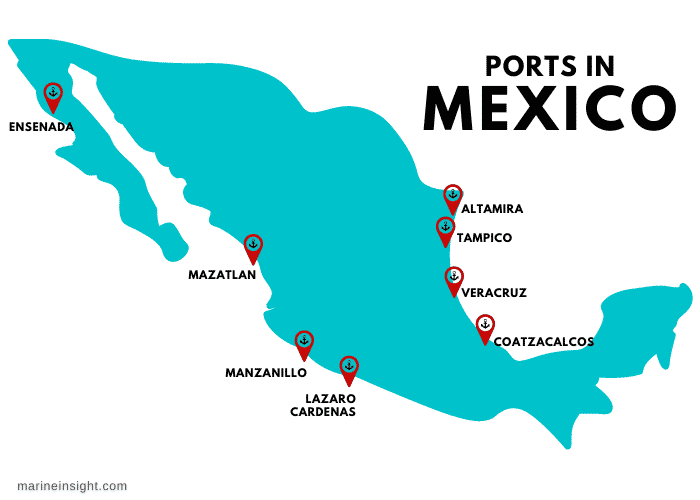
Image Source: Google
Mexico Imports & Exports
The Mexican economy is a developing market economy. According to IMF, the economy is the 16th largest in the world in terms of GDP and the 13th by sales power parity. The economy continues to develop due to rapid growth in modern industries and service sectors.
Mexico’s shipping ports had the best year in 2021, with a record of 7.85m teus. According to statistics, imports registered 3.98m teus and export of 3.87m teu compared to previous years. This figure marked an increase of 21.5% against 6.46m teus in 2020.
China Makes Mexico Import Gains
In the last few years, China’s presence in Mexico has tremendously impacted the country’s economy. According to data, the trade between China and Mexico recorded $100 billion in 2021. The importation from China amounts to over 90% of trade in the international market between China and Mexico. In reality, Mexico’s trade with China hangs mostly on imports. More is imported from China to Mexico ($83.05 billion in 2019) compared to exports ($7.14 billion).
From the above record, the importance of shipments in international trade cannot be over-emphasized. Business owners must find the right port destination in Mexico for safe and secure cargo delivery. Involving the services of shipping companies like Zggship handles all your concerns with shipping from China to Mexico. Shipment options from China to Mexico include; air freight, sea freight, express shipping.
Mexico Shipping Ports: A Full List
As we further consider the shipping ports in Mexico, below is a list of the different ports. Note that these ports are selected on account of being the largest, busiest, and main ports in Mexico.
Also, if you will ship goods from China to Mexica, you should seek the service of a reliable efficient china freight forwarder who understands Mexico’s shipping requirements. The Mexico shipping ports are;
#1 Port of Manzanillo
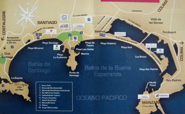
Image Source: Google
- Port basic or overview
- Port code: MXZLO
- Port size: Covers 437 hectares of land
- Port address: Av. Teniente Azueta No. 9 Col. Burocrata Manzanillo, Colima C.P. 28250 Mexico
- Main vessel type: Pacific Ocean cargo
- TEUs: 3.37 million TEUs
The port of Manzanillo lies on the western Pacific Coast of Mexico in the State of Colima. The port was established in 1971 but suffered a poor relationship between the workers and the previous administration. However, the government of Mexico established the National Commission for Port Coordination, which successfully handled the situation, leading to its progress over the last 40 years.
In 2021, the port handled millions of TEUs, an increase of 15.9% from the previous years, making it one of Mexico’s busiest and main shipping ports.
The distance between Manzanillo port and China is about 7,749 miles, equivalent to 12,471 kilometers. To learn more about the port of Manzanillo, visit their website or location, where you’ll gain more info.
#2 Lazaro Cardenas Port
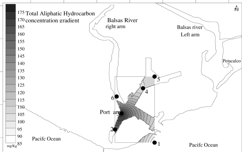
Image Source: researchgate.net
- Port basic or overview
- Port code: MX LZC
- Port size: 185 hectares
- Port address: Prol. Av. Lazaro Cardenas No. 1 Colonia Centro Ciudad Lazaro Cardenas, Michoacan C.P. 60950 Mexico
- Main vessel type: Cargo ship
- TEUs: 2,250,000 TEUs (annually)
Lazaro Cardenas Port is located at the tip of the river Rio Balsas in the state of Michoacan, Mexico. Being home to the deep-water seaport, Lazaro Cardenas port is the largest seaport in Mexico and one of the largest in the Pacific Ocean basin. The port’s annual capacity delivery of 25 tonnes of cargo and 2.2 million TEUs makes it the second busiest in Mexico.
The port is soon becoming a major container capacity facility because of congestion at the US ports and its closeness to Houston, Chicago, Kansas City, etc. The port of Lazaro Cardenas also ships to and from China at a distance of 13,413 kilometers. Learn more about the port of Lazaro Cardenas
#3 Port of Veracruz
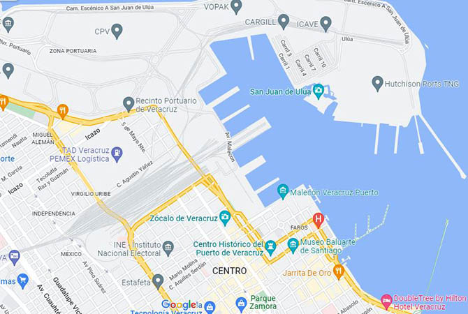
Image Source: Google
- Port basic or overview
- Port code: MXVER
- Port size: Large
- Port address: Av. Marina Mercante No. 210, 7 piso, Col. Centro, Veracruz, Veracruz 91700, Mexico
- Main vessel type: Diverse cargo such as wheahttps://www.google.com/t, petroleum coke, vegetable oil, machinery, metal scrap, chemicals, etc.
- TEUs: 965,290TEUs (2016)
The Port of Veracruz was founded in the early 1600s by Hernan Cortes. The port of Veracruz was Corte’s base for conquest inland to Tenochtitlan. The port prospered from being the major link between Spain and colonial Mexico. Several products/goods, like wines, domestic animals, cotton, rice, wheat, etc., are being shipped to Europe through the port.
Port of Veracruz is Mexico’s main seaport on the east coast. It is one of Mexico’s biggest and most important ports serving all of southern and central Mexico through roads and railways. Despite its hot weather, tourists keep trooping into the city of Mexico to enjoy its natural warmth, especially during weekends.
The distance between the Port of Veracruz and China is about 13,523 km. You can learn more about the port of Veracruz.
#4 Port of Altamira
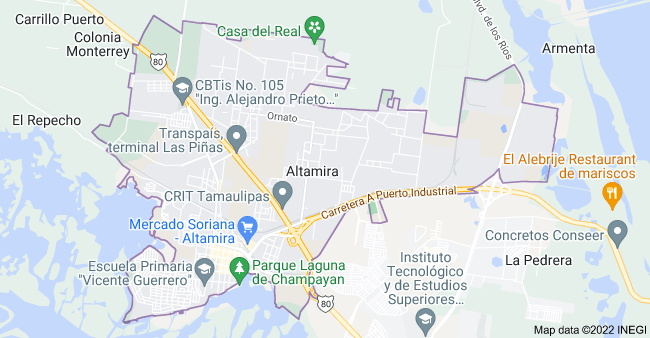
Image Source: Google
- Port basic or overview
- Port code: MXATM
- Port size: Small
- Port address: Calle Río Tamesí km. 0+800 Puerto Industrial de Altamira, Tamaulipas C.P. 89608 Mexico
- Main vessel type: Containerized cargo for ocean-going ships
- TEUs: 821,645TEUs
The port of Altamira is on the north-central shores of the Gulf of Mexico. The port is the industrial and economic center for the regions in the country and the state of Tamaulipas, San Luis Potosi, Coahuila, etc.
The city of Altamira was established in the 18th Century by Don Jose de Escandon. However, the deep-water Port of Altamira was founded in the 1980s when the federal government needed to expand the Port of Tampico, about 24 km north of Tampico. The port of Altamira was to supplement the cargo traffic handled by the port of Tampico.
Today, the Port of Altamira handles petroleum, sugar, LNG, copper, coffee, hides, and containerized cargo. It carries around 1550 ships and 12,185,000 tonnes of cargo. As the fourth-largest port in Mexico, it handles about 821,645 TEUs yearly, networking with countries in the US and Mexico. Its average distance from China is about 15943 nautical miles. Learn more about the port of Altamira by visiting its location.
#5 Port of Ensenada
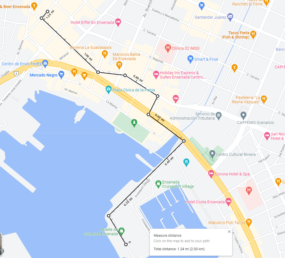
Image Source: Cruise Critic
- Port basic or overview
- Port code: MXESE
- Port size: 9000 square miles (Medium)
- Port address: Blvd. Tte. José Azueta No. 224 Int Recinto Portuario, C.P. 22800 Ensenada Baja Int Recinto Portuario, 22800 Ensenada, B.C., Mexico
- Main vessel type: Cargo (limestone, cotton, bagged stones, sands, etc.
- TEUs: 394,911 TEUs (2021)
The Port of Ensenada lies on the shores of Todos Santos Bay off the Pacific Ocean of Baja, California, Mexico. The port is known for its vacation spot for people in southern California, luxury hotels, etc. It was opened to trade in 1877, several years after the Todos Santos Bay was discovered.
Due to its strategic position near the US border and the Pacific Rim, the Port of Ensenada has access to international shipping routes, connecting it with 64 ports in 29 countries. As one of the largest ports in Mexico, the port of Esendana exports millions of tons, thousand of tons of cabotage, and cargos ranging from minerals, perishables, and liquified natural gas.
The average distance of the port from China is about 9353 kilometers. To trade with the port of Ensenada, learn more about its services and network coverage.
#6 Port of Tuxpan
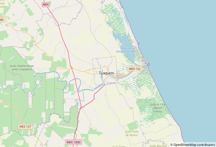
Image Source: Adnavem.com
- Port basic or overview
- Port code: MXTUX
- Port size: Medium
- Port address: Carretera La Barra Norte km. 6.5, Ejido La Calzada Tuxpan, Veracruz C.P. 92800 Mexico
- Main vessel type: Seaport cargo
- TEUs: 27 TEUs
Port of Tuxpan, sometimes referred to as Puerto de Tuxpan, is located on the banks of the Tuxpan River, 12 kilometers connecting the Gulf of Mexico on the east-central shores. The name ‘Puerto de Tuxpan’ originated from the Nahuatl language of the ancient Aztecs, which means ‘place of rabbit.’
The distance between the Port of Tuxpan and China is about 13,294 km. Over the years, millions of tons of cargo passing through the port, ranging from petroleum products, agricultural bulk, mineral bulk, etc. If you need to ship cargo from the port of Tuxpan to any country, learn more about their detailed services.
#7 Port of Mazatlan
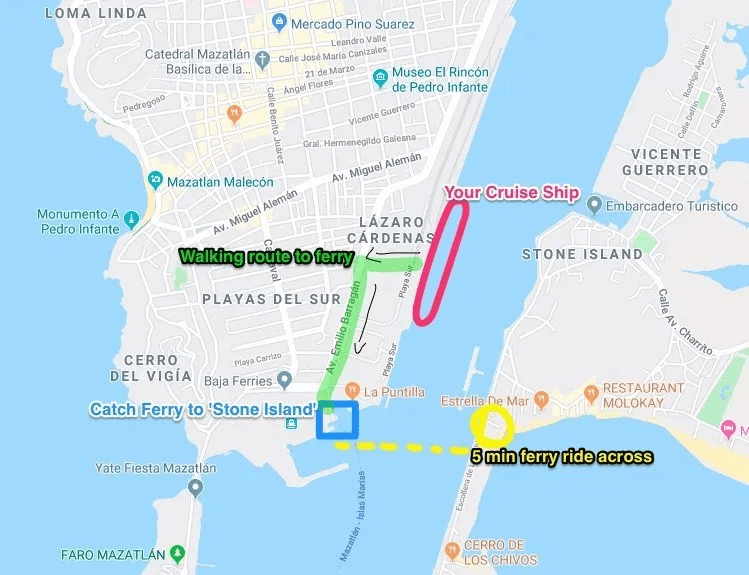
Image Source: Pinterest
- Port basic or overview
- Port code: MXMZT
- Port size: Large
- Port address: Playas del Sur, 82040 Mazatlán, Sinaloa, Mexico
- Main vessel type: Agricultural and Industrial cargo
- TEUs: 41,895 TEUs (2021)
The Port of Mazatlan, also known as Puerto de Mazatlan, was a small town predominantly occupied by fishers until the early 1800s. In 1829 a Filipino established trading with vessels being transported from the United States, Europe, Asia Pacific, Peru, etc.
Located on the north-central shores of western Mexico, the Port of Mazatlan has developed over the years to become a regular port for cruise ships and ferries and the fourth biggest port in the country. The port’s economy depends largely on agro-based industries like fish meal and brewing and industrial cargo such as steel, automobile, etc.
If you’re looking to ship goods from the port of Mazatlan to China, the average distance you’ll cover is about 12,694 km; you can learn about the port for adequate information.
#8 Port of Guaymas
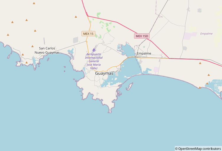
Image Source: Adnavem.com
- Port basic or overview
- Port code: MXGYM
- Port size: Medium (83.7 hectares)
- Port address: Recinto Portuario S/N, Zona Franca, 85430 Col. Punta Arena Guaymas, Son., Mexico
- Main vessel type: Cargo
- TEUs: 175,000 TEUs yearly
The Guaymas town was established in 1769 by Jose de Galvez. However, the port of Guaymas gained city status in 1859. In the 19th Century, the Port of Guaymas, also known as Puerto de Guaymas, grew to become Mexico’s most important northwest port, making it attractive to the military that attacked the port in time past.
Aside from its beautiful mountains, Puerto de Guaymas is a shipping, commercial, manufacturing, and tourism center. About 6.6 million tonnes of cargo and more than 1000 ships passed through the port in 2020. Its major exports include copper, sulfuric acid, wheat, cotton, vegetables, etc.
The Port of Guaymas covers shipments between China, Japan, and Chile. Its average distance to China is about 12,020 km. Contact its authority to learn more about the Port of Guaymas trade with China.
Conclusion
As we draw our conclusion of the largest, busiest, and main shipping ports in Mexico, other main shipping ports that aren’t discussed in this blog, are listed below;
If you’re looking for the ports listed in Mexico, do well to contact us at Zggship, our specialty is helping businesses find their footing in the shipping industry.


