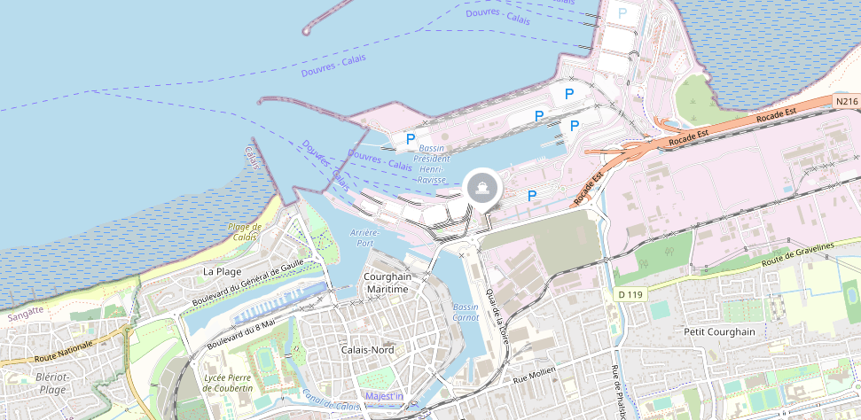
Image Source: France Ferry Booker
- Port code – FRCQF
- Port size – 160 hectares
- Port addresses – Calais Ferry Port, Terminal E, Calais, 62100, France
- Main cargo/vessel type – Containers, cargo cruise ships, and passenger vessels
- TEUs – Around 100,000 to 500,000 TEUs annually
The Port of Calais is a major port located in the commune of Calais in northern France. It lies at the entrance of the Strait of Dover, providing access to the English Channel and connecting France to the UK. Meanwhile, its distance from China is 14,400 nautical miles.
It is the fourth largest port in France and the largest when it comes to passenger traffic. The port boasts a wide range of cargo handling and storage facilities.
The port also provides a range of services to its clients, including customs clearance, warehousing, and fully integrated logistics. Historically, the Treaty of Le Touquet provided juxtaposed jurisdiction to the port. France and the United Kingdom have respective shares in developing the port as to what it is today.
Read on to learn more about the Port of Calais.
Ports in France
If you need to deliver goods to other cities in the Netherlands, you may opt for other strategic ports of France.
Ship From or to Calais Port
Contacting a freight forwarding firm is the best way to get valuable shipping deals. ZGGShip is a leading China-based freight forwarder that can work with the well-renowned shipping companies in the list above. Find More info about shipping from China to Netherlands here.


